
ULS Land Surveying provides precision boundary, topographic, ALTA, and construction staking services.
See the land clearly before you build, design, grade, or invest. Utah Land Surveying provides detailed topographic surveys that document elevations, contours, slopes, improvements, and existing site conditions for homeowners, builders, engineers, architects, developers, contractors, and municipalities.
A topographic survey is a detailed measurement and mapping of the physical features and elevation changes across a property. Rather than focusing primarily on legal property lines, a topographic survey documents the shape of the land and the visible conditions that may influence design, engineering, construction, drainage, access, and future development.
The easiest way to understand a topographic survey is to think of it as a measurable map of how the land rises, falls, and functions. It can show high and low areas, slopes, contours, drainage patterns, existing improvements, access points, retaining walls, pavement, vegetation, and other site features included within the requested scope.
Land that appears simple or relatively flat can still contain elevation differences and physical constraints that affect project cost, grading, stormwater movement, utility placement, building location, and long-term performance. A professional topographic survey turns those conditions into practical data that architects, engineers, contractors, and property owners can use.
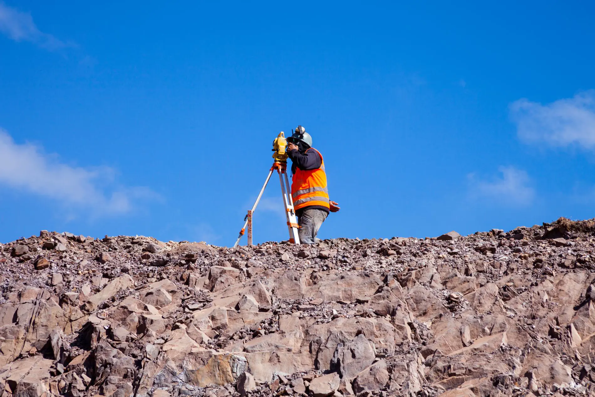
The exact survey scope is tailored to the project. A topographic survey can document the elevations, terrain relationships, improvements, and visible features needed to support planning, design, engineering, permitting, and construction.
Document spot elevations and contour lines that show how the land rises, falls, and changes throughout the surveyed area.
Identify steep areas, gradual slopes, high points, low points, and grade transitions that may affect design or construction.
Map visible drainage paths, swales, ditches, channels, low areas, inlets, and other surface features related to water movement.
Show buildings, walls, driveways, pavement edges, curbs, walkways, retaining features, and other existing improvements within scope.
Document significant trees, vegetation limits, rock features, embankments, and other visible conditions that may affect planning.
Include visible utility structures, access points, roads, paths, and other site elements when required by the project scope.
A topographic survey is most valuable before design decisions become construction commitments. Completing the survey early gives project teams a dependable picture of existing site conditions before grading, drainage, structural placement, utility routing, or improvement plans are finalized.
Provides existing-condition data for architectural plans, civil engineering, structural coordination, site design, and other professional design work.
Supplies elevation information used to evaluate drainage, establish grading strategies, plan stormwater improvements, and understand surface flow.
Supports building placement, roads, driveways, utility planning, retaining walls, site preparation, and larger development decisions.
Useful before additions, detached structures, major landscaping, shops, access improvements, retaining walls, or other projects affected by terrain.
Topographic surveying combines project planning, field measurements, positioning technology, elevation data, digital processing, and professional drafting. The final scope is based on how the information will be used and the level of site detail the project requires.
We begin by discussing the property, project purpose, design needs, required features, desired deliverables, and intended use of the topographic information.
The survey area, elevation density, visible features, utility structures, improvements, contours, and drafting requirements are identified before fieldwork begins.
Our team reviews access, terrain, vegetation, structures, surface improvements, drainage features, and other conditions that may influence field data collection.
Using professional-grade GPS, total station, robotic, and digital field equipment as appropriate, we collect horizontal positions, elevations, distances, angles, and visible feature data.
Collected points are reviewed and processed into spot elevations, contours, surface relationships, feature mapping, and the requested topographic deliverable.
We provide the completed survey information in a usable format for owners, architects, engineers, contractors, agencies, or other members of the project team.
Planning with incomplete site information can lead to redesigns, grading complications, drainage failures, inefficient layouts, utility conflicts, change orders, construction delays, and budget overruns. A topographic survey helps project teams identify existing conditions before those conditions become expensive field problems.
Accurate site information also supports more sustainable and durable development. Projects can be designed around the natural shape of the land, helping reduce unnecessary disturbance, excessive grading, material waste, and avoidable rework.
GPS, total stations, robotic instruments, digital field collection, and drafting software support accurate site measurement and mapping.
Elevation points and contours reveal subtle grade changes, slopes, high areas, and low areas that may not be obvious by sight alone.
Topographic data gives architects, engineers, contractors, and owners a shared existing-condition reference for project planning.
Survey information can support grading, drainage, permitting, site planning, utility coordination, construction, and development.
Topographic survey pricing depends on the amount of fieldwork, elevation data, visible feature mapping, digital processing, drafting, and project coordination required. Property size matters, but a smaller site with steep terrain, dense improvements, limited access, or extensive detail can require more work than a larger open parcel.
Topographic surveys provide more than a general picture of a property. These answers explain how elevation data and existing-condition mapping can support planning, engineering, construction, and long-term site use.
A topographic survey can document elevations, low areas, slopes, drainage paths, and other surface conditions that may contribute to water accumulation. The survey itself is not a drainage design, but it provides the site data engineers and contractors may need to evaluate the problem and develop a solution.
Yes. Land that appears flat can still contain subtle elevation differences that influence drainage, grading, foundation planning, access, and construction. Professional measurements identify changes that may be difficult to estimate visually.
Yes. Retaining wall and grading plans depend on accurate elevation relationships across the site. A topographic survey documents those relationships so engineers, designers, and contractors can plan more effectively.
It can, depending on the requested scope. Topographic surveys may include significant trees, fences, walls, structures, pavement, driveways, utility structures, drainage features, and other visible improvements relevant to planning or design.
Not necessarily. Drone data can be useful for certain projects, but professional topographic surveying still depends on appropriate control, field verification, survey-grade measurements, and methods matched to the required accuracy and intended use.
It can help. Better existing-condition data gives designers and contractors a clearer understanding of terrain, elevations, drainage, access, and physical constraints before construction begins. This may reduce surprises, redesigns, field conflicts, and avoidable revisions.
Often, yes. Engineers, architects, designers, contractors, and reviewing agencies may rely on topographic information to understand existing conditions during planning, design, engineering, and permit review.
A survey may need to be updated when grading, construction, demolition, utility work, drainage improvements, or major landscape changes alter the site. An older survey may no longer accurately represent current conditions after substantial work occurs.
Yes. Reliable site data supports more efficient grading, drainage, infrastructure placement, access planning, structural positioning, and material use. Better information at the beginning can reduce unnecessary work later.
The usefulness of the survey depends on accurate field measurements, appropriate elevation coverage, clear drafting, relevant feature mapping, and a scope aligned with the project’s actual needs. A minimal survey may not provide enough information for a complex engineering or development project.
Whether you are planning construction, engineering, grading, drainage improvements, utility work, a new driveway, a retaining wall, property development, or another site improvement, a topographic survey can provide the reliable existing-condition data needed to move forward with greater confidence. Contact Utah Land Surveying today to request a quote.
Request Topographic Survey Quote